Modeling Tropical Cyclones in EEMS
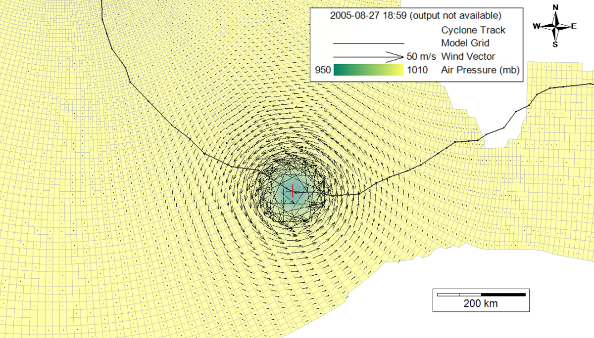
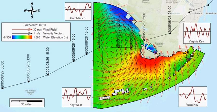
A tropical cyclone is a system of rapidly rotating wind around a low-pressure center that produces extreme winds, gusts, and heavy rainfall.
A tropical cyclone is a system of rapidly rotating wind around a low-pressure center that produces extreme winds, gusts, and heavy rainfall.
The Lagrangian Particle Tracking (LPT) module in EFDC+ was developed by DSI in 2009 and has served as an effective tool for solving numerous problems in fluid dynamics.
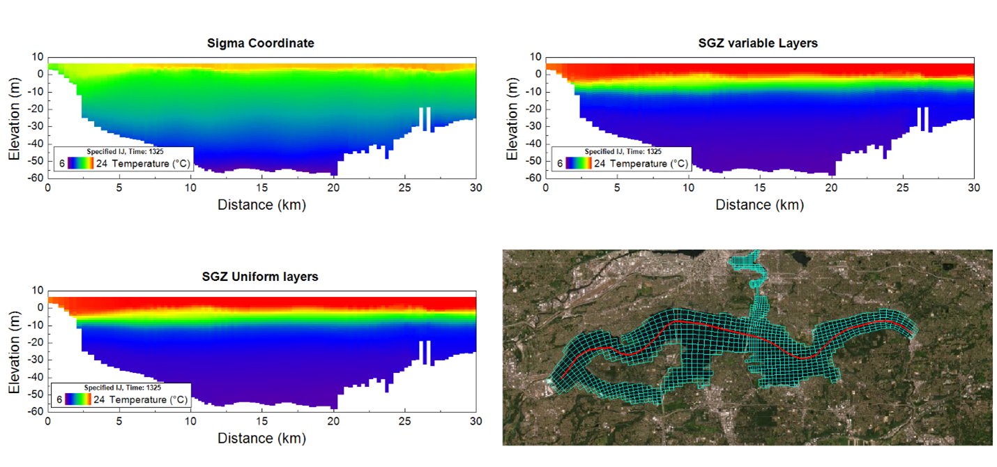
EFDC+ is a versatile hydrodynamic model capable of operating in 1-, 2-, or 3-dimensional (3D) modes. For 3D simulations, EFDC+ allows users to choose from two vertical layering schemes
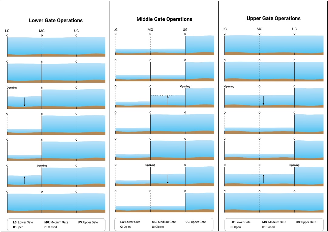
A lock is a hydraulic structure employed to facilitate the movement of boats, ships, and similar watercraft between different water levels on rivers and canals.
EEMS10 now has the ability to simulate spatially and temporally varying fields, such as a wind or barometric pressure fields.
DSI has added a new capability to EFDC+ 10.1. This new capability allows the model to simulate partially blocked depths due to floating objects
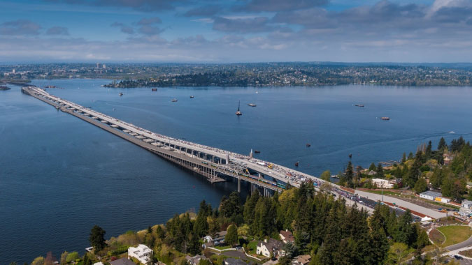
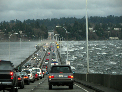
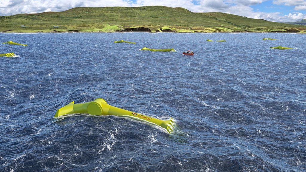
Lake Washington is a very deep lake that made conventional bridge construction difficult. To allow a traffic to cross the lake, a floating bridge was constructed.
Following the implementation of COARE 3.6 in the EFDC+ code, a new option for calculating water surface heat exchange has been added.
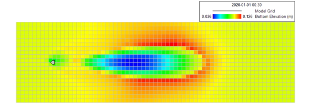
Simulation of the impacts of propeller wash in hydrodynamic and sediment transport models requires detailed information on ship travel routes and the physical characteristics of each ship.
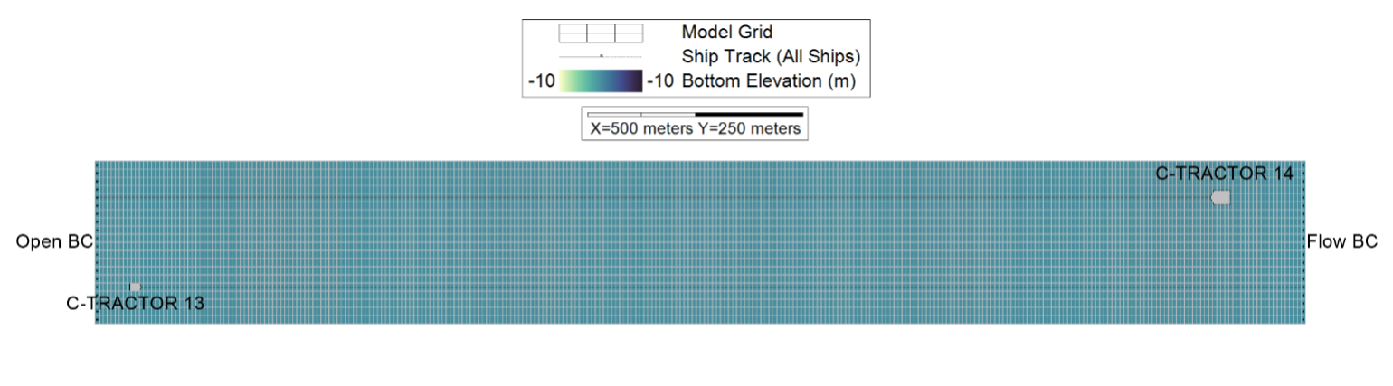
A 3D EFDC+ simulation showing how propeller wash from passing ships breaks up a 100 ppt hypersaline bottom layer in a navigation canal.
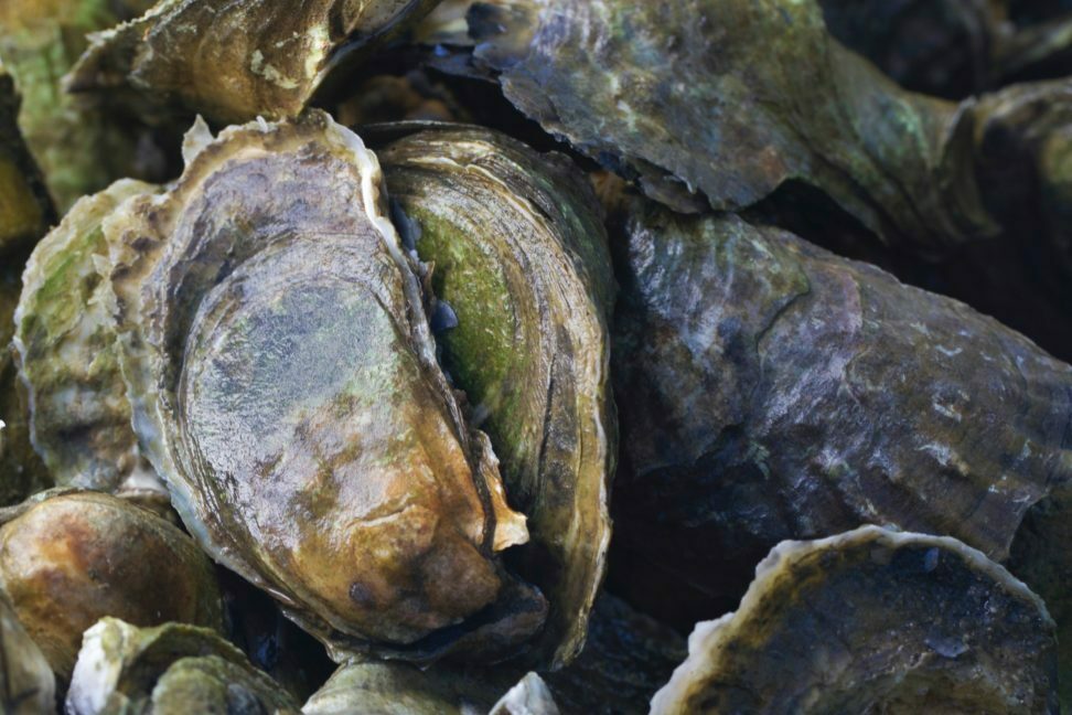
The new shellfish sub-model in EEMS10.2 was used to replicate the Kobayashi et al., (1997) test case
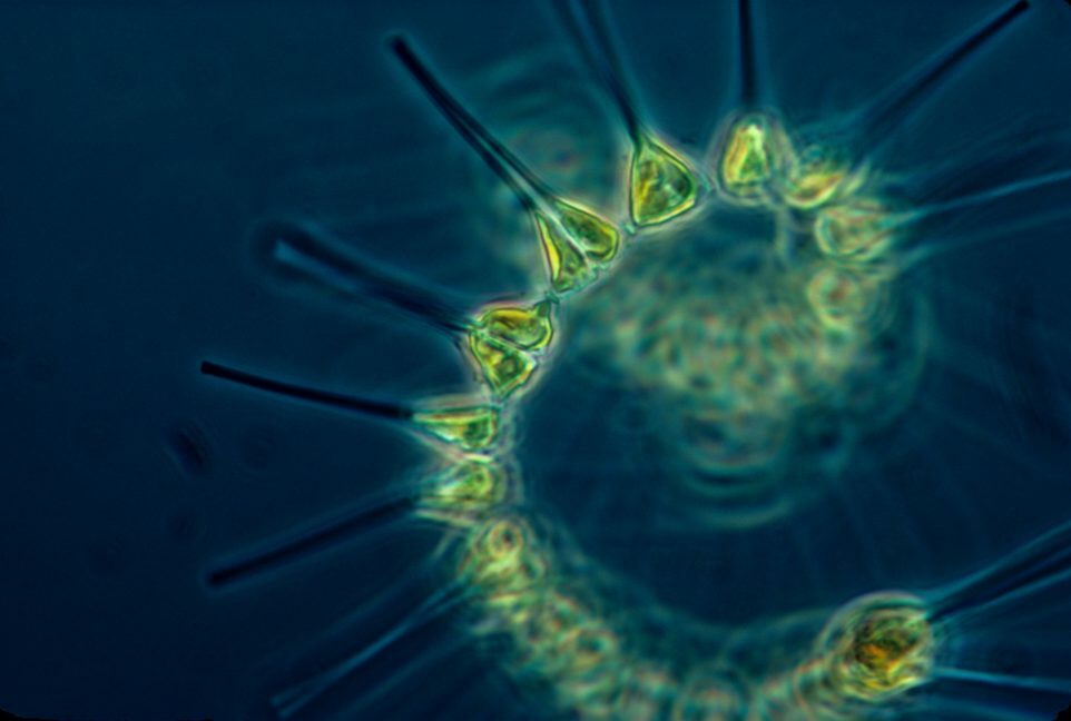
In our earlier water quality blogs, we provided a preview of new features in the upcoming version of EEMS which will include unlimited phytoplankton and zooplankton classes
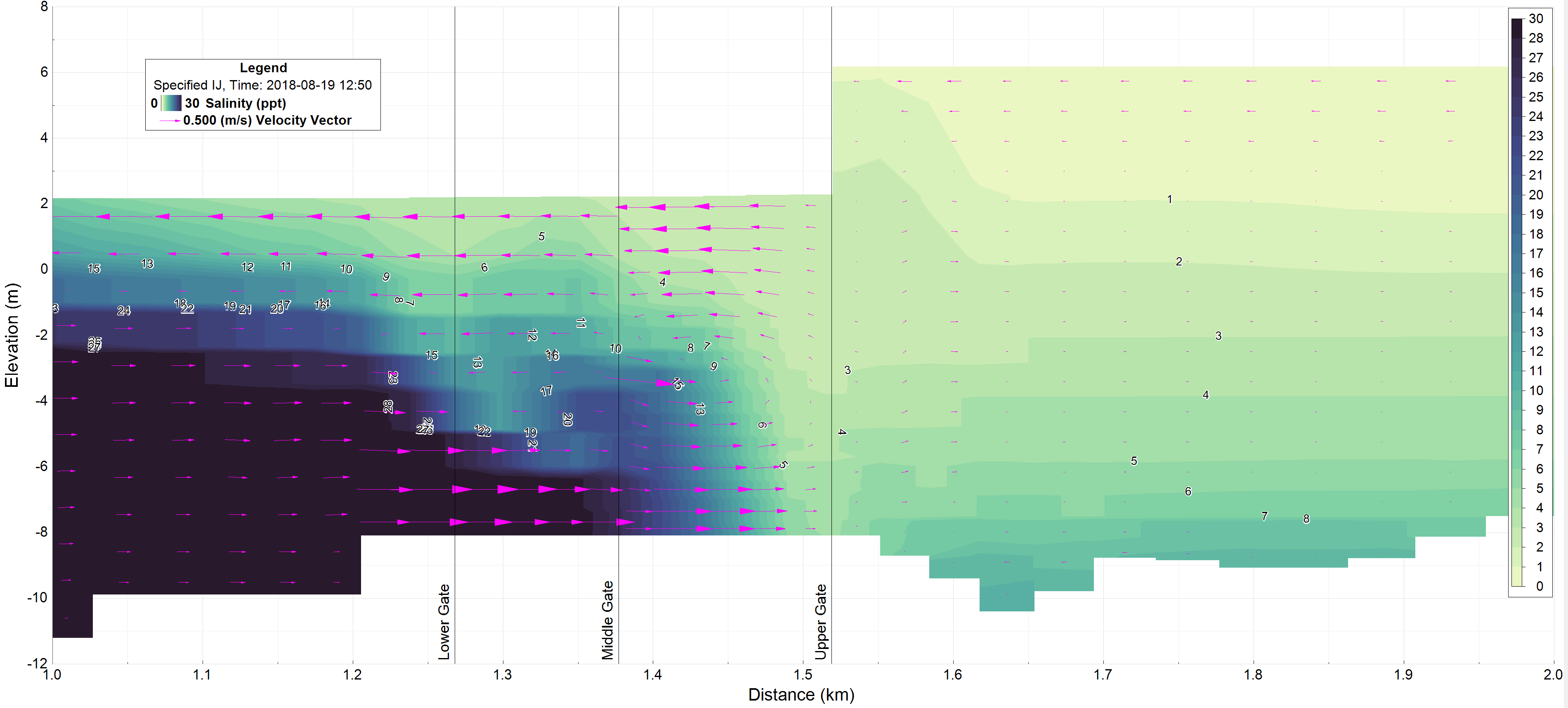
Learn how EFDC+ modeling helps understand salmon migration challenges through the Ballard Locks by simulating complex temperature and salinity dynamics in Lake Washington Ship Canal.
High wind speeds associated with hurricanes are capable of producing extreme waves, and high winds, currents, and tides can combine to create storm surge.
DSI is continually developing new features for EFDC+ and EFDC+ Explorer Modeling System (EEMS).