In-Person EEMS Training Edmonds, WA · Sept 21–23, 2026 Register →
EFDC+ Grid Generation

Grid+

Build high-quality curvilinear orthogonal grids for any river, estuary, or coastline — then run the model without leaving the window.

500,000+ cells in a single grid
1-click global orthogonalization
4 models EFDC+, ECOM, CH3D & DELFT3D

Everything a grid needs, in one place

Grid+ combines multiple generation methods, powerful conditioning and optimization, and direct bathymetry interpolation — all with interactive editing and continuous quality feedback. Build, edit, connect, and orthogonalize in one iterative workflow, with the model run always one click away.

Build

Complex grids, fast

Generate Cartesian, radial, or curvilinear orthogonal grids straight from georeferenced data, and iterate freely on resolution, IJ orientation, and orthogonality — every experiment backed by robust undo/redo.

  • Cartesian, radial/polar & curvilinear orthogonal grids
  • Schwarz-Christoffel conformal mapping & spline generation
  • Adaptive spacing that concentrates resolution where it matters
  • Live online background maps & an extensive shortcut-key library
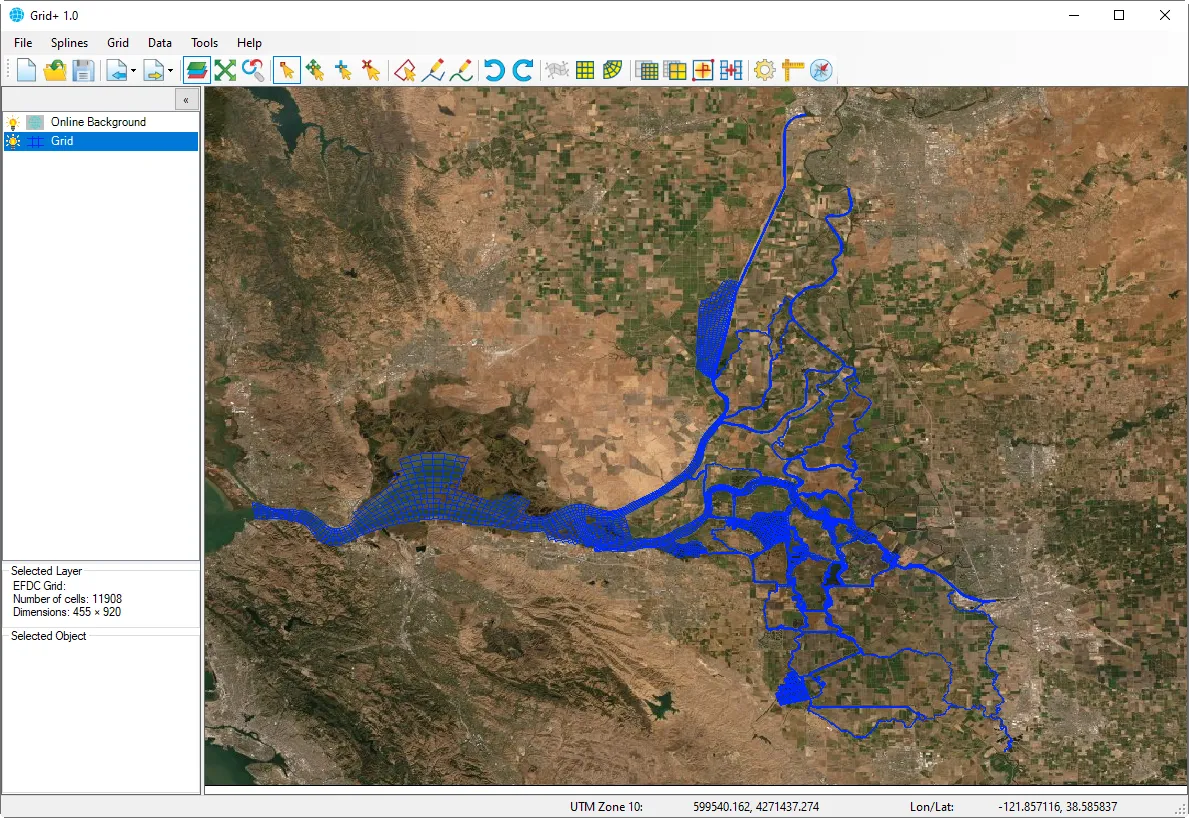
Editing an EFDC+ grid inside the Grid+ interface
Edit

Refine without starting over

Import an existing EFDC+ grid, keep its I,J map intact, and shape it in place — move nodes and blocks, smooth, refine, coarsen, and fit the domain to real land boundaries.

  • Move nodes and grid blocks by point, line, or area
  • Line-based, block-based & Laplacian smoothing
  • Refine with splines or coarsen by I/J factors
  • Mirror regions, and attract or repel grid lines
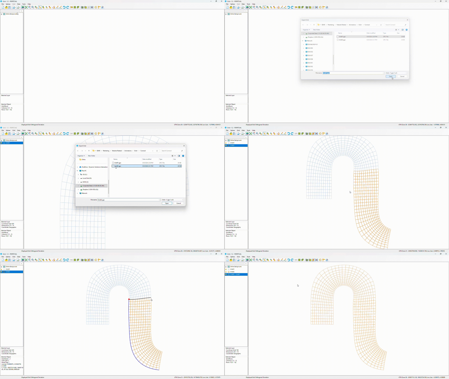
Two separate grids loaded and connected into one unified grid

Two separate grids loaded and connected into one unified grid

Two separate grids loaded and connected into one unified grid
Connect

Assemble grids modularly

When a domain is too intricate for one grid, build sub-grids and stitch them into a single unified grid — save each piece, then show, hide, split, and reassemble as the model demands.

  • Join multiple grids together with overlap handling
  • Build, save & manage modular sub-grids as files
  • Split existing grids to refine, then reassemble
  • Purpose-built for complex river networks
One-click global orthogonalization in Grid+

One-click global orthogonalization in Grid+

One-click global orthogonalization in Grid+
Orthogonalize

Grid quality, automated

Minimize orthogonal deviation across the whole domain or within targeted sub-regions, with fine control over the optimization and continuous feedback on grid quality.

  • One-click global optimization
  • Configurable outer, boundary & inner iterations plus smoothing factor
  • Local refinement of problem areas
  • Fewer numerical errors, better results

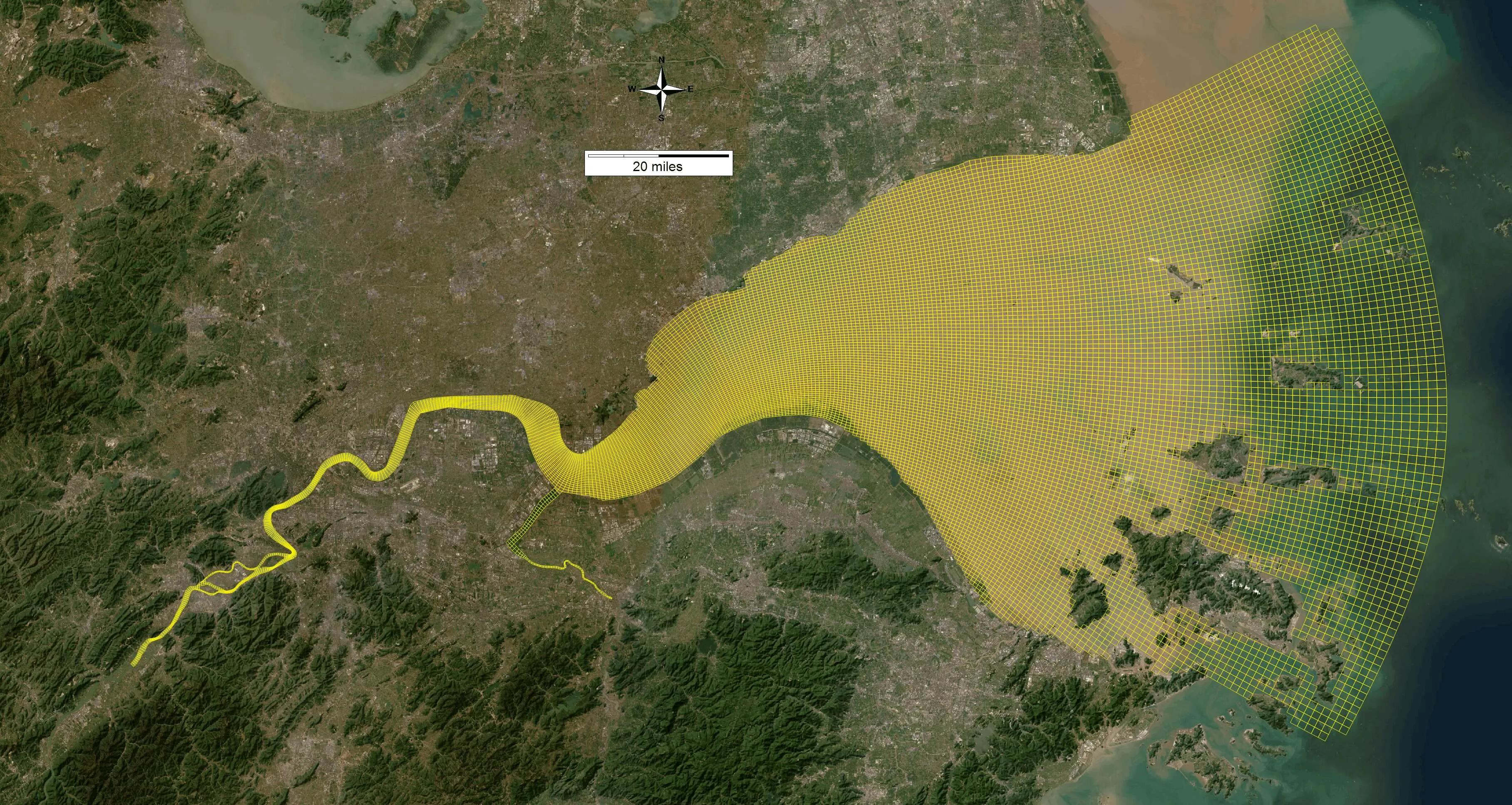
Examples from the world's hardest domains

From braided tropical rivers to engineered coastlines, Grid+ handles geometry that stops other tools cold.

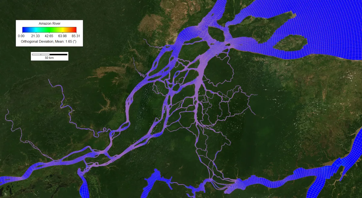
Curvilinear orthogonal grid of the Amazon River built in Grid+

Amazon River

Riverine

Braided, multi-channel geometry captured in one continuous grid.

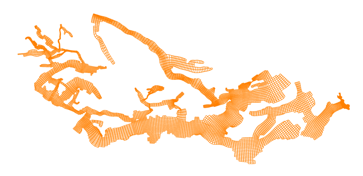
Sacramento–San Joaquin Delta grid built in Grid+

Sacramento–San Joaquin Delta

Delta

A vast network of branching channels resolved in one unified grid.

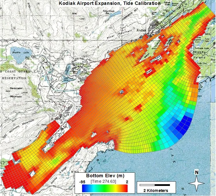
Kodiak Airport expansion coastal grid built in Grid+

Kodiak Airport Expansion

Coastal

High-resolution coastal grid for an engineered nearshore project.

From skewed to solved, in one operation

Poor orthogonality quietly corrupts your results. Grid+ fixes it across the whole domain with a single click — no manual node-nudging.

Live in Grid+ — one-click global orthogonalization.

Live in Grid+ — one-click global orthogonalization.

Live in Grid+ — one-click global orthogonalization.

One real pass — average orthogonal deviation

Before 7.43
After 0.25

−97% average deviation

A closer look at the toolset

Under the intuitive interface is a complete, professional grid-generation engine.

Generation methods

Schwarz-Christoffel conformal mapping
Analytically map arbitrary polygons to structured grids, using Delaunay triangulation and a Broyden nonlinear solver.
Spline-based generation
Build grids from boundary splines and control points using transfinite interpolation.
Adaptive spacing
Concentrate resolution where it matters with distance-weighted spacing.

Conditioning & optimization

Orthogonalization
Improve grid orthogonality with configurable outer, boundary, and inner iterations and a smoothing factor.
Smoothing
Apply line-based, block-based, and Laplacian smoothing with distance-weighted influence.
Refinement & coarsening
Refine the grid using splines or coarsen it by I/J factors.
Mirroring
Reflect grid regions across a line.
Line attraction / repulsion
Pull grid lines toward, or push them away from, features of interest.

Boundary & node operations

Land-boundary fitting
Snap grid edges to polyline land boundaries.
Spline boundary fitting
Fit grid edges to curves.
Node operations
Add, delete, and move individual grid points.
Block operations
Move, delete, and modify rectangular grid blocks by point, line, or area.
Grid connection
Join multiple grids together with overlap handling.

Bathymetry & elevation interpolation

Block depth tools
Uniformly assign, additively offset, and scale depths over a block.
IDW interpolation
Inverse-distance-weighted interpolation from point clouds, with configurable power and neighbor count.
Line-based interpolation
Interpolate along I- or J-lines, with boundary-value extension.
Geographic accuracy
Haversine (spherical) distance for geographic coordinates.

Continuous quality feedback

Live metrics on orthogonality, aspect ratio, cell area, I/J spacing, minimum spacing, and node elevation help you build grids that run cleanly and accurately — so problems surface while you build, not after the model runs.

Build and run in a single environment

Grid+ is fully integrated into EEMS. Launch it from Tools → Edit Grid with Grid+ inside EFDC+ Explorer and generate model input files in the same interface — grid to simulation with no exporting, converting, or tool-switching.

  • Launches from EFDC+ Explorer — Open Grid+ from the Tools menu and write model input files without leaving the workspace.
  • Live online maps — Dynamic background maps with lat/long, multiple sources, and Google Earth imagery — cutting setup time from the first click.
  • Online bathymetry — Pull bathymetric data straight into your domain, so depth is built into the grid rather than bolted on later.

Bring grids in. Send grids out.

Grid+ speaks the formats your projects already use — import legacy grids, overlay third-party files, and export to EFDC+ and beyond.

Import & overlay
  • EFDC
  • ECOM
  • CH3D
  • RGFGrid
  • AutoCAD DXF
  • ESRI Shapefile
  • Georeferenced bitmap
  • Google Earth
Export & run
  • EFDC+
  • EFDC Explorer
  • ECOM
  • CH3D
  • DELFT3D

Available as a standalone grid generator, or fully embedded in the EFDC+ Explorer Modeling System.

Dam with mountains