About BASINS
Better Assessment Science Integrating Point & Nonpoint Sources
Official release and documentation directly from the U.S. EPA.
BASINS (Better Assessment Science Integrating point and Nonpoint Sources) is a powerful, freely available multipurpose environmental analysis system developed by the US EPA. It provides a seamless framework that brings together modeling tools, environmental datasets, and geographic information into a single GIS interface — eliminating the need to juggle multiple platforms.
Directly from the BASINS interface, users can download the critical data they need for analysis, including DEMs, hydrography, land use classifications, meteorological records, monitoring data, and soil maps — all sourced from trusted agencies like the EPA and USGS.
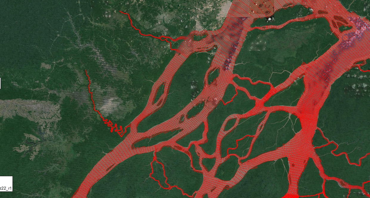
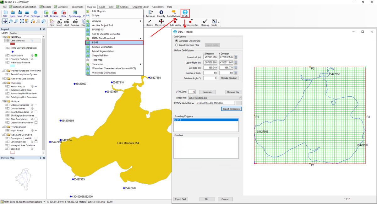
The EEMS plugin for BASINS bridges the gap between watershed models and receiving water hydrodynamic models. It allows users to move seamlessly from broad basin-scale studies to detailed analyses of specific water bodies — including the downstream impacts of pollutant loading.
This plugin represents the first step in a larger vision: deeper integration between hydrologic and hydrodynamic modeling tools that simplifies data exchange and empowers environmental professionals to tackle complex water quality challenges with greater efficiency. Learn more on our blog.
EEMS Plugin
EEMS for BASINS
Install from the EEMS download center, then follow the demo below to get started.
Demo
See it in action
A full guided walkthrough of the plugin from the EEMS-BASINS development team.