Shoreline Erosion
Erosion of shorelines can be a significant problem in both open and confined waters.
Challenges with Shoreline Erosion
Erosion of shorelines can be a significant problem in both open and confined waters. Natural events such as rainfall and run-off, and large ships navigating restricted waterways can cause sediment resuspension. It is important to understand the processes of soil erosion and sediment transport along rivers to identify the areas vulnerable to erosion and find potential measures to reduce the environmental effects.
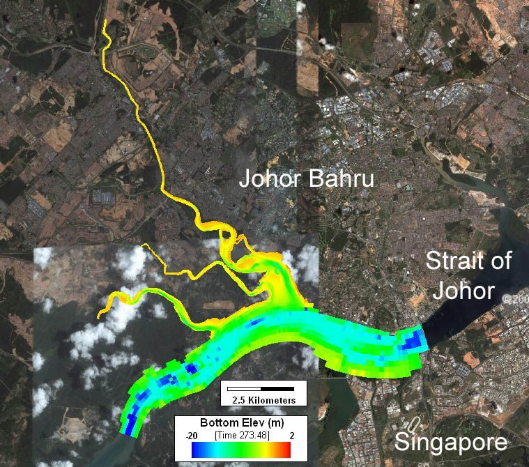
EEMS has extensive capabilities for simulation of erosion and sediment transport. EE features many tools that allows the users to visualize the model domain including background maps and images. EE also features extensive post-processing options that allows the user to interpret the model results. The sediment sub-models in EFDC+ includes simulation of cohesive and non-cohesive sediments. EFDC+ also includes the state-of-the-art SEDZLJ sub-model developed by Sandia National Labs.
EEMS was used to carry out a hydraulic study to assess the impacts to the environment in the project area of the proposed Vision City of the South, Johor. Outputs from the study included before and after project implementation flooding, shoreline water levels, velocity patterns, and sedimentation and scour patterns. Recommendations on mitigation measures to reduce the impact of the proposed project on the environment were also provided.