BATHYMETRY
BATHYMETRY
BATHYMETRY
The Importance of Bathymetry in Environmental Modeling
At DSI, we have a saying, “BATHYMETRY, BATHYMETRY, BATHYMETRY.” We even made a T-shirt with this slogan because bathymetry provides the foundational data needed for the realistic hydrodynamic representation of the physical environment in which the model operates. A well-developed hydrodynamic model is necessary for all the subsequent environmental simulations, such as dye tracer, sediment transport, chemical fate & transport, and eutrophication.
Bathymetry is the study of underwater depths in lakes, rivers, and estuaries. It is crucial for understanding the underwater terrain of a water body, and it serves multiple purposes, including water resource management, navigation, engineering, and environmental monitoring. Detailed maps of underwater topography are essential for understanding how variations in depth influence water flow, sediment transport, and ecological habitats. This data is critical for predicting a waterbody’s responses to environmental stresses such as floods, sediment accumulation, and the impact of human activities like dam operations.
Environmental Modeling Requirements for Bathymetry
Numerical modeling is the best solution when experimental techniques are time-consuming, difficult, or even impossible. This means environmental models such as EFDC+ provide the key to many problems, especially in decision-making for engineering design and resource management.
However, these models are only as good as the data that drives them. Defective or poor-quality input will result in similarly poor-quality output. GIGO means that the data that drives the model must be as accurate as possible. To solve hydrodynamic and water quality equations, appropriate initial and boundary conditions must be set.. Bathymetric data is a crucial initial condition that provides the foundational framework upon which the hydrodynamic processes occur. While the boundary conditions specify the values or behaviors at the edges of the model domain, bathymetry is used to set up the model domain itself. This means the bathymetry directly influences flow patterns, velocities, and water levels within that domain.

Bathymetry
Hydrodynamics
- 1, 2, and/or 3D
- Sigma Stretched
- Sigma-Zed
- Wind Circulation
- Wave Impacts
- Heat Coupled Ice
- Vegetation
- Wetting / Drying Hydraulic Structures
- Propeller Wash
General/Temperature & Salinity
- Unlimited Tracers
- Conservative
- Decay and Growth
- Age of Water
- Temperature
- Salinity
- Lagrangian Particle Tracking
- Oil Spill
Sediment Transport
- Original / SEDZLJ Approach
- Unlimited Number of Sediment
- Classes
- Cohesive(s)
- Non-Cohesives
- Bedload
- Hard Bottom
- Propeller Wash
Water Quality
- ICM Kinetics
- 19 Nutrient Forms
- Unlimited Algal Classes
- Sediment Diagenesis
- Rooted Plant Epiphyte
- Shellfish Farms
- Unlimited Zooplankton Classes
Chemical Fate and Transport
- Metals
- Persistent Organic Pollutants
- 1-2-3 Phase Partitioning
- Coupled to Original Approach
- Coupled to SEDZLJ
- Degradation
- Volatilization
Some of the areas in which numerical models are most often used are listed below. Each of these has the requirement of accurate bathymetric data.
- Flood Extent Modeling: During storms, especially when combined with high tides, deeper channels and submerged shoals can guide floodwaters inland. The bathymetry determines how well these flood extents can be modeled and plan for effective flood management.
- Storm Surge Impact: Shallow or rapidly changing bathymetric zones can amplify storm surges, posing greater inundation threats to coastal populations. Understanding the bathymetry of the area is required to predict and mitigate these risks.
- Tidal Propagation: The depth and morphology of the seabed influence the speed and amplitude of tidal waves. Accurate bathymetric data helps predict tidal patterns and their impact on coastal areas.
- Coastal Erosion: Bathymetry data is essential for understanding and predicting coastal erosion rates. These erosion rates are vital for designing coastal defenses and managing shoreline changes.
- Navigation Safety: Accurate bathymetric maps are crucial for safe navigation, helping to avoid underwater hazards and optimize shipping routes.
- Ecosystem Management: Bathymetry supports ecosystem-based management by predicting the impacts of human activities on coastal habitats and fisheries.
In summary, bathymetry provides the foundational data for accurate hydrodynamic models, which are essential for coastal planning, disaster management, and environmental protection.
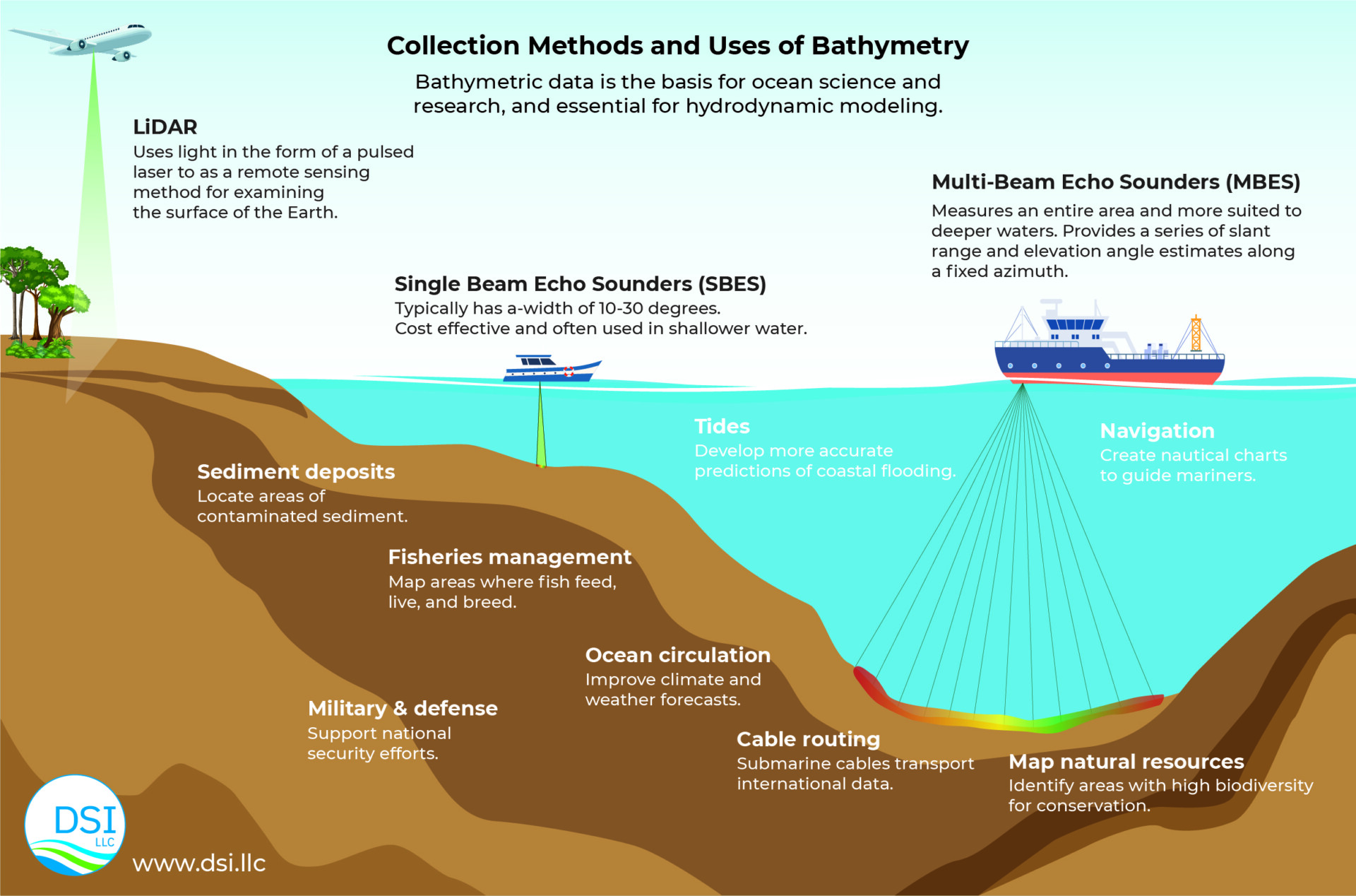
Collecting Bathymetric Data
Beyond simple mapping, by comparing bathymetric information from the same location at different times (e.g., across multiple years), it is possible to quantitatively assess elevation changes in the riverbed, identifying patterns of erosion and deposition in a given period. Such analyses are invaluable for understanding sediment dynamics and informing targeted management strategies for sediment-related issues. Advanced technologies like multi-beam sonar can be employed to collect detailed bathymetric data. This facilitates the creation of accurate datasets reflecting the morphology of the waterbody bottom topography. Multi-beam, single-beam, and Lidar can be merged into comprehensive floodplain, nearshore, and deep-water topography. These data support various waterbody management activities, including dredging, habitat restoration, and flood management (Smith, 2017).
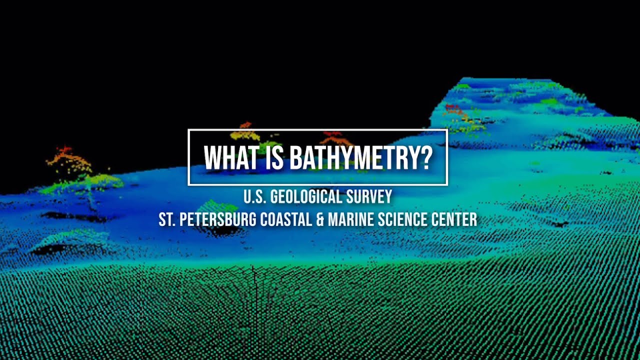
USGS provides this helpful video to explain how bathymetric data is acquired.
Processing of Bathymetric Data
Before building a hydrodynamic model, it is essential to have a clear statement of study objectives and constraints, including scheduling. The area of interest should be clearly defined, and a list of questions or problems to be addressed by modeling developed.
The grid must be sufficiently refined, so that it is coarse enough to run in a reasonable time, and fine enough to provide answers to the questions that will be asked of the model. Preparation of the bathymetric data for the building of model involves a number of steps as outlined below:
- Data Cleaning: After receiving raw data, it is processed to remove any noise or errors. This may involve filtering out outliers, correcting for sound velocity variations, and compensating for tidal effects, and identifying and filling data gaps to ensure a continuous and accurate dataset.
- Data Validation: The processed data is checked for accuracy and completeness. This may involve comparing it with known benchmarks or conducting additional surveys in areas with poor data coverage.
- Data Visualization: The bathymetric surface is visualized using software tools such as Grid+ and EFDC+ Explorer that generate 2D maps or 3D models of the seafloor. These visualizations help in understanding the underwater terrain and identifying features like ridges, valleys, and structures.
- Data Reduction: Large datasets are often reduced to a manageable size while preserving important features. Techniques like interpolation or data thinning are used.
- Data Interpolation: To create a continuous surface, the discrete data points are interpolated as appropriate for that final grid. The grid will be generated using a tool such as Grid+. Common interpolation methods include kriging, inverse distance weighting, and splines.
This video shows how to add bathymetric data to a grid to develop an EFDC+ model.

Building a Hydrodynamic Model
It is important to follow a standard process in developing a hydrodynamic model. We have a checklist we often use. Furthermore, DSI have developed several training videos which provide insight into how to develop such models.
This training video focuses particularly on coastal models.

Do you want to build hydrodynamic models for yourself? You can start by downloading EEMS, activating the free demo mode, and then running our demonstration models. To see these features in action, head over to our YouTube page.
References
Ji, Zhen-Gang, Hydrodynamics and Water Quality, 2008.
Brooker, Zoe, 2024. The Importance of Bathymetry in Coastal Modeling. Centre for Ocean Mapping.
Rojan. 2024. The role of bathymetry in Hydrodynamic Modeling and Coastal Resilience, Curious Seekers Hub